![]()
SITECH UK & Ireland, the leading distributor of Trimble® technology, now offers an innovative progress tracking software solution that uses drones to help site managers map, measure and manage their sites more effectively. Trimble® Stratus, powered by Propeller, is a data analytics and visualisation platform that is designed specifically for earthmoving applications to help contractors track progress and productivity. Harnessing the power of highly accurate surveying and mapping capabilities, contractors are able to avoid costly delays and minimise rework.
Unlike other industries that are embracing digitalisation, earthworks and construction have traditionally lagged behind and have been slow to innovate. For example, many construction companies still rely on traditional methods of surveying, such as pegs, to map a project. This often requires skilled surveyors that can make the necessary calculations and interpret the data. However, their time on site is limited, and it isn’t always easy to access this expertise when you need it.
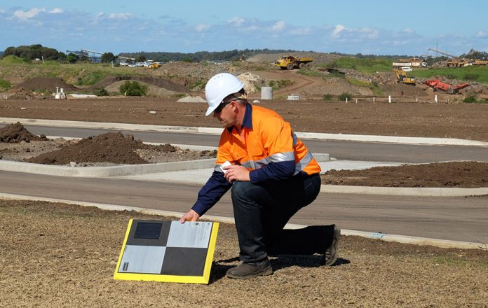
SITECH now supplies Trimble® Stratus to help construction companies digitise and overcome common surveying issues. The new package uses Trimble’s ® Connected Site solutions and delivers a new end-to-end solution for contractors. This means that contractors can place and activate their ground control points and then fly their drone to collect site data. Using Trimble® Stratus, you can then upload and view this data and share it between the site, office and across the team. This can help prevent miscommunication and ensure that everyone in the company is updated on site progress.
“If manual surveys are inaccurate, construction companies can see a decline in performance and see delays that mean they fall behind schedule and go over budget,” explained Ian Barnes, Head of Business at SITECH UK & Ireland. “By using drone technology, surveyors can access highly accurate data to ensure operations remain on schedule. Companies can also remove employees from difficult to access and dangerous areas, like quarries, improving safety as well as accuracy.”
“While other software tries to accommodate a broad category of users, Trimble Stratus is 100 percent focused on earthmoving and construction environments,” explained Jan Wouter Kruyt, Director of European Operations at Propeller. “The cloud-based platform is also really intuitive and can be used without surveying expertise ─ the drone images are processed in Trimble Stratus and then visualised as an interactive, measurable 3D terrain models. It’s easy to create and share measurements on these 3D maps.
“The new package delivers several benefits for construction companies, including capabilities to compare designs and minimise rework by generating highly accurate survey data,” continued Kruyt. “Most importantly, having frequent up-to-date survey data on hand means that companies can complete projects ahead of schedule and under budget, something that’s becoming more important as companies try to get back on track following lockdown.”
“Trimble® Stratus is ground-breaking for construction companies that want to enhance their surveying,” continued Barnes. “By harnessing the power of drone technology and combining this with a Trimble® platform, contractors now have access to highly accurate progress tracking with a solution designed specifically for earthworks projects like theirs.”
Interested in using Trimble® Stratus to help you plan your site? Visit our website and find out more about what we offer https://www.sitechukandireland.com/sitech-drone-services/.


